 Landscape Photography
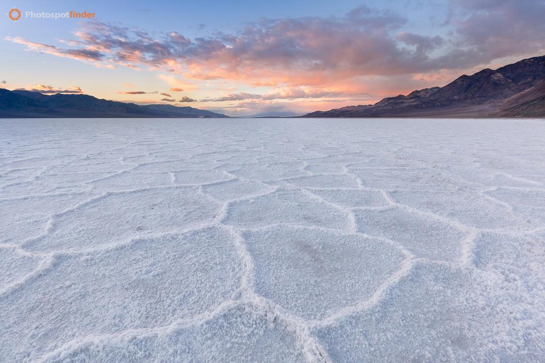
Badwater Basin Salt Polygons at Sunset, Death Valley, California
This photograph captures the salt polygon formations at Badwater Basin, located within Death Valley National Park in eastern California. Badwater Basin marks the lowest point in North America at 282 feet below sea level and represents a closed basin where evaporating water leaves behind extensive salt deposits. Seasonal flooding and drying cycles cause the salt crust to fracture into geometric polygon patterns, making the area a key geological feature of the park. The image was taken at sunset, with low-angle light skimming across the salt flat and defining the raised polygon edges through subtle shadow and contrast. A wide-angle perspective places strong emphasis on foreground texture, allowing the repeating patterns to lead the eye toward the distant mountain ranges on both sides of the basin. Soft clouds catch warm color near the horizon, while cooler tones remain in the salt and surrounding terrain, creating clear tonal separation. For landscape photographers, Badwater Basin offers consistent compositional opportunities when light remains low. Positioning the camera close to the ground strengthens scale and depth, while shooting toward the setting sun enhances texture without harsh highlights.

|
Canon EOS 6D EF16-35mm f/4L IS USM |
||
|
|
f/16.0 |
|
1/6 sec |
|
|
100 |
|
16 mm |